Penang Bridge
Gelugor, Penang

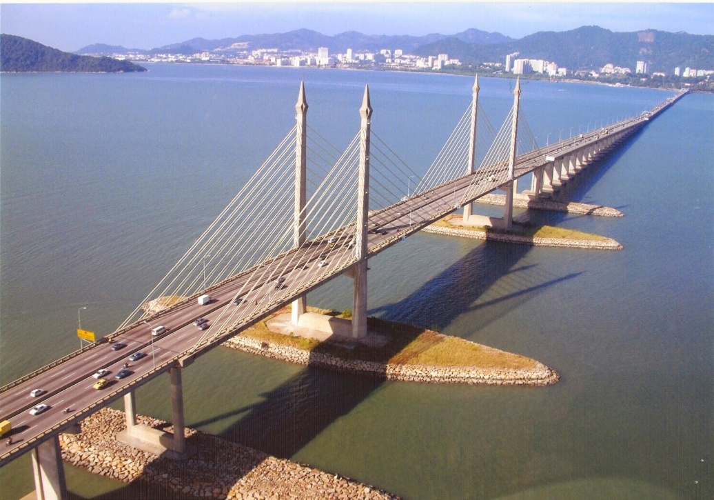
The Penang Bridge is a 13.5km (8.4-mile) dual carriageway toll bridge and controlled-access highway in the state of Penang, Malaysia. The bridge connects Butterworth on the mainland side of the state with Gelugor on the island, crossing the Selatan Strait. The bridge was inaugurated on 14 September 1985 and it is the first road connection between the peninsula and the island. The bridge is well known as the second-longest bridge in Malaysia and the fifth-longest in Southeast Asia by total length, with a length over water of 8.4 kilometres (5.2 miles). The current concession holder and maintainer of the bridge is PLUS Expressway.
Before the bridge was built, Penang Ferries carried passengers between Butterworth and George Town. In the early 1970s, the idea to build a bridge linking Seberang Perai to Penang Island was suggested by the 2nd Prime Minister of Malaysia’s Tun Abdul Razak and the 2nd Chief Minister of Penang’s Tun Dr Lim Chong Eu.
At the end of 1971, the Malaysian government appointed Christiani Nielsen A/S of Denmark to carry out a feasibility study. In the year 1976, Penang Bridge was planned during the term of 3rd Prime Minister of Malaysia’s Tun Hussein Onn.
In November 1976, Howard Needles Tammen & Bergendorf of USA in association with Jurutera Konsultant (SEA) Sdn. Bhd. of Malaysia was appointed to design and supervise the construction of the bridge.
On 23 July 1981, Works Minister of Malaysia’s Dato Seri Samy Vellu announced that Penang Bridge, Penang would be constructed using the cable-stayed concrete girder of the San Francisco’s Golden Gate Bridge instead of the steel-tied arch in the style of the Sydney Harbour Bridge.
Source : penangbridge.com.my
Route description
The route begins at the Penang Bridge interchange with the North–South Expressway Northern Route and Jalan Perusahaan Perai. The route then briefly goes southwest, where island-bound commuters proceed to pay the bridge toll. At the shore where the bridge begins, the route turns westwards, crossing the Selatan Strait. In the middle of the bridge, the route bends slightly northwest towards Gelugor. On the island side, the route ends at the shore at its interchange with the Tun Dr Lim Chong Eu Expressway and the Gelugor Highway.
Source : wikipedia
https://www.youtube.com/watch?v=-GZeNDH8H5w
https://www.youtube.com/watch?v=A9H8k68vmVQ
https://www.youtube.com/watch?v=c7fjhSL46gs
Reviews
Rate this article