Kangra
Kangra, located at a distance of 230 kms from Manali, is the most populous district of the Indian state of Himachal Pradesh, India. Dharamsala is the administrative headquarters of the district. It is home of Masroor Rock Cut temple, also known as Himalayan Pyramids and wonder of the world for being likely contender for the UNESCO World heritage Site.
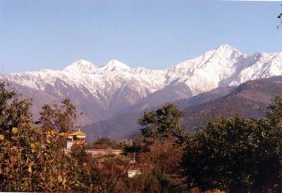
The altitude of the district ranges from 427 to 6401m above mean sea level, with the lowest being in the plains areas bordering Gurdaspur district of Punjab in the west and Una and Hamirpur districts of H.P to the south while the highest being amidst the Dhauladhar mountain range which forms the border with Chamba and Kullu districts.
The Beas is one of the major rivers of this district and contributes to the fertility of the land here. Dharamsala, the district headquarters, is also the headquarters of the Tibetan government-in-exile, headed by the His Holiness the Dalai Lama.
Source : wikipedia.
Climate
Summer : The temperature varies from 220 C to 380C
Winter : The temperature varies from 00 to 200C
Nearest airport : Gaggal Airport, NH20, Dharamshala, Himachal Pradesh 176209
Phone:0189 223 3430
Railway Station : The nearest railway station is Kangra railway station, Himachal Pradesh of Kangra Valley Railway line, 94 kms. away
https://www.youtube.com/watch?v=tdsi5h3t6mw
https://www.youtube.com/watch?v=NN6umZ01E3U


Places Of Interest
Baijnath Temple
KangraShare this:
Baijnath Temple NH20, Baijnath, Himachal Pradesh 176125 Phone : 0189 426 3126 Baijnath, a small township in the Dhauladhar range of western Himalayas, 16 km from Palampur in the Kangra District of Himachal Pradesh is famous for its 13th century temple dedicated to Siva as Vaidyanath, ‘the Lord of physicians’. Originally known as Kiragrama, the town … Continue reading Baijnath Temple →
Kangra Fort
KangraShare this:
Kangra Fort Old Kangra, Kangra, Himachal Pradesh 176001 The Kangra Fort is located 20 kilometers from the town of Dharamsala on the outskirts of the town of Kangra, India. The entrance to the fort is through a small courtyard enclosed between two gates which were built during the Sikh period, as appears from an inscription over the entrance. From here a … Continue reading Kangra Fort →
Masroor Rock Cut Temple
KangraShare this:
Masroor Rock Cut Temple Lahalpur, Masroor, Himachal Pradesh 176026 Phone : 098050 74444 The Masroor Rock Cut Temple or Himalayan Pyramid is a complex of temples located in Masroor in Kangra valley, which is 40 kilometres (25 mi) from Kangra city in Kangra district of the Indian State of Himachal Pradesh. It is now known as ‘Thakurwada’, meaning “Vaishnavite temples”. It is a complex of monolithic rock cut … Continue reading Masroor Rock Cut Temple →
Palampur
KangraShare this:
Palampur Palampur is a green hill station and a municipal council in the Kangra valley in the Indian State of Himachal Pradesh, surrounded by tea gardens and pine forests before they merge with the Dhauladhar ranges. Palampur is the tea capital of northwest India but tea is just one aspect that makes it a special interest place. Abundance of water and proximity to the mountains has … Continue reading Palampur →
Pong Dam Lake
KangraShare this:
Pong Dam Lake Maharana Pratap Sagar located 50 kms from Kangra, in India, also known as Pong Reservoir or Pong Dam Lake was created in 1975, by building the highest earthfill dam in India on the Beas River in the wetland zone of the Siwalik Hills of the Kangra district of the state of Himachal Pradesh. Named in the honour of Maharana Pratap (1572–1597), the reservoir or the lake is … Continue reading Pong Dam Lake →