Everest Base Camp

Everest Base Camp is either one of two base camps on opposite sides of Mount Everest (It could also be any Everest base camp on a given route, but this is less common since the two main routes became standardized). South Base Camp is in Nepal at an altitude of 5,364 metres (17,598 ft) (28°0′26″N 86°51′34″E), and North Base Camp is in Tibet at 5,150 metres (16,900 ft) (28°8′29″N 86°51′5″E). These camps are rudimentary campsites on Mount Everest that are used by mountain climbers during their ascent and descent. South Base Camp is used when climbing via the southeast ridge, while North Base Camp is used when climbing via the northeast ridge.
Supplies are shipped to the South Base Camp by sherpas or porters, and with the help of animals, usually yaks. The North Base Camp has vehicle access (at least in the summer months). Climbers typically rest at base camp for several days for acclimatization to reduce the risks and severity of altitude sickness.
South Base Camp in Nepal
The Everest Base Camp trek on the south side is one of the most popular trekking routes in the Himalayas and is visited by thousands of trekkers each year. Trekkers usually fly from Kathmandu to Lukla to save time and energy before beginning the trek to this base camp. However, trekking to Lukla is possible. There are no roads from Kathmandu to Lukla and as a result, the only method of transporting large and heavy goods is by plane.
In 2015, it was noted that about 40,000 people per year take the trek from the Lukla airport to the Nepal Everest Base Camp.
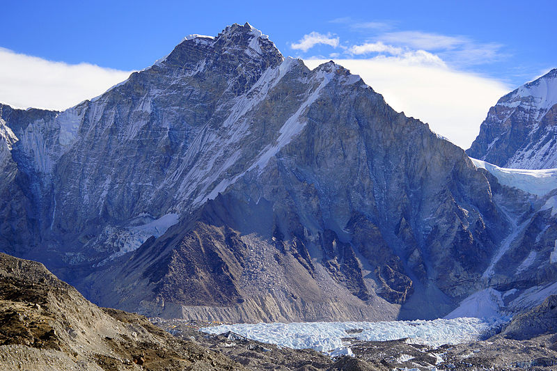
From Lukla, climbers trek upward to the Sherpa capital of Namche Bazaar, 3,440 metres (11,290 ft), following the valley of the Dudh Kosi river. It takes about two days to reach the village, which is a central hub of the area. Typically at this point, climbers allow a day of rest for acclimatization. They then trek another two days to Dingboche, 4,260 metres (13,980 ft) before resting for another day for further acclimatization. Another two days takes them to Everest Base Camp via Gorakshep, the flat field below Kala Patthar, 5,545 metres (18,192 ft) and Mt. Pumori.
On 25 April 2015, an earthquake measuring 7.8 on the moment magnitude scale, struck Nepal and triggered an avalanche on Pumori that swept through the South Base Camp. At least 19 people were said to have been killed as a result. Just over two weeks later, on May 12, a second quake struck measuring 7.3 on the Mw. Some of the trails leading to Everest Base Camp were damaged by these earthquakes and needed repairs.
North Base Camp in Tibet
A visit to the North (China-side) Base Camp currently requires a permit from the Chinese government, on top of the permit required to visit Tibet itself. Such permits must be arranged via travel companies in Lhasa as part of a package tour that include hiring a vehicle, driver, and guide. The North Base Camp is accessed by vehicle through a 100 km road branching to the South from the Friendship Highway near Shelkar. From the Base Camp, all tourists must take the buses managed by the government to limit the traffic in the last stretch of gravel road to a marked hill at 5,200 meters above sea level just before the climbers’ camp. It is also possible to trek up from the tourist camp, but only when properly acclimatized. The “tourist Base Camp” is located about halfway between Rongbuk Monastery; the actual climbers’ Base Camp is at the foot of Rongbuk glacier.
Source : wikipedia
https://www.youtube.com/watch?v=elq7tkE46WQ
https://www.youtube.com/watch?v=_BgW7gdHGBI
Rate this article